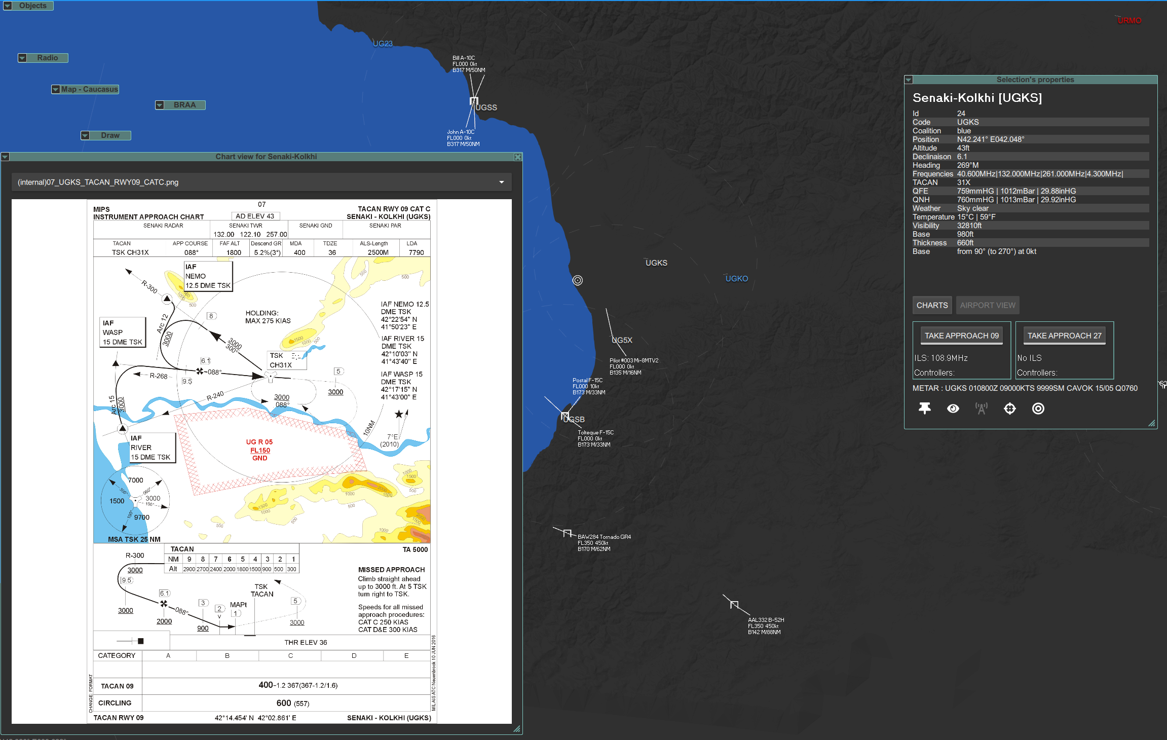
What is it ?
Charts can be displayed on airports, it can be airport approach or taxi charts. You can add your own charts also, see below.

How I use it ?
In LotAtc Client or LotAtc Advanced, click on airport, then use the “Charts” button to display charts.
Add more charts ?
You can add your own charts by respecting the following rules :
- Have the airport name or the airport code in the file name
- Use PNG format
- Store them in
C:\users\you\LotAtc Data\Client\airports\charts\<theatre>\directory
Theatre names are:
- caucasus
- nevada
- normandy
- persiangulf
- thechannel
- syria
- marianaislands
- world
- falklands
- sinaimap
- kola
- afghanistan
- germanycw
Additional charts
- Papi’s charts are directly available in LotAtc, just select them (Papi charts components) during installation or using Add/remove components.